June 4, 2018 Data Preprocessing with PCI and Python Satellite Data Preprocessing with Python/PCI I (Import & Ortho) Satellite Data Preprocessing with Python/PCI II – Cloud Masking, Haze Removal, Terrain Derivates – ATCOR Categories Software/Teaching/Workflow
June 4, 2018 
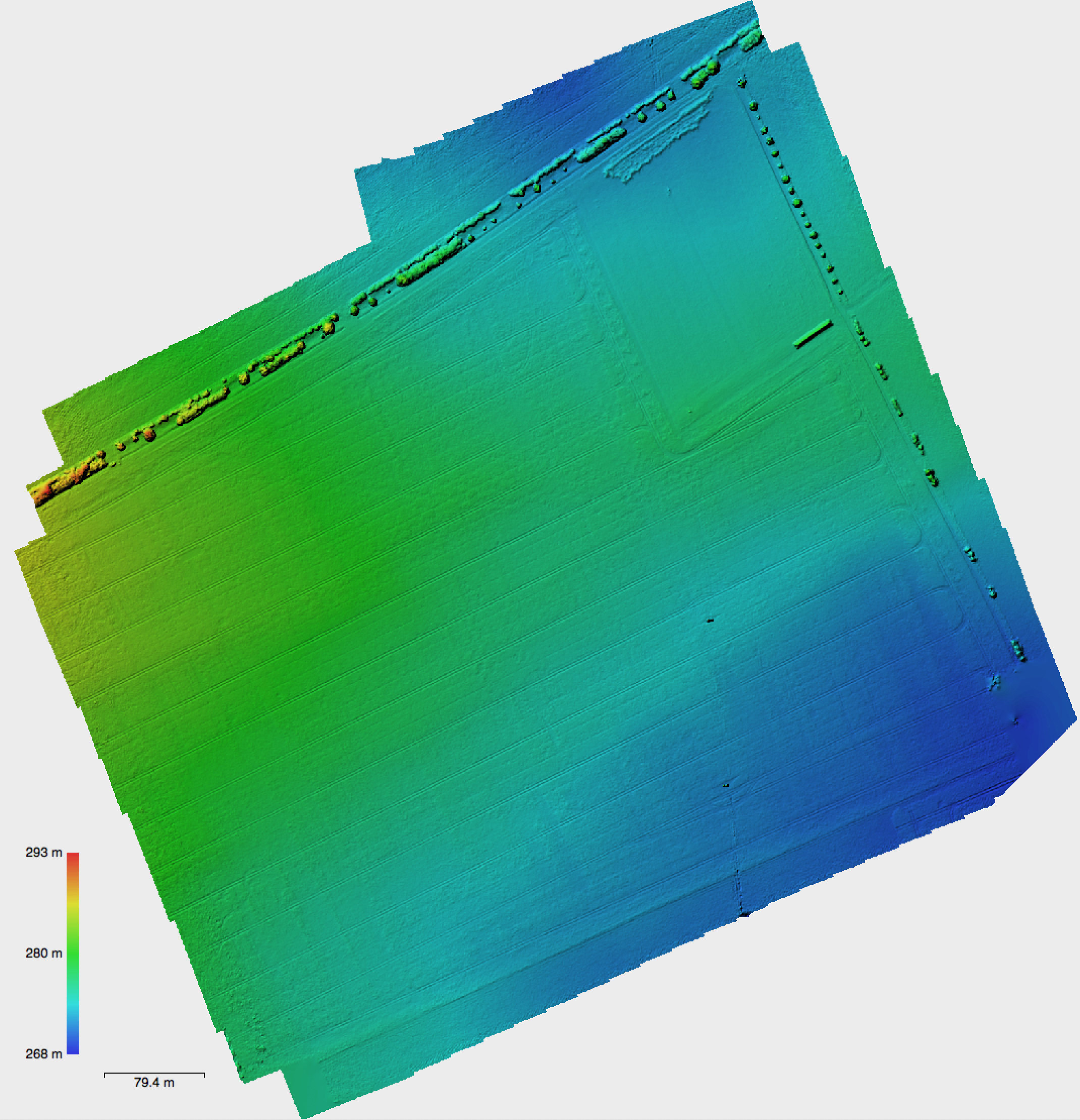
Intra field growth variability 
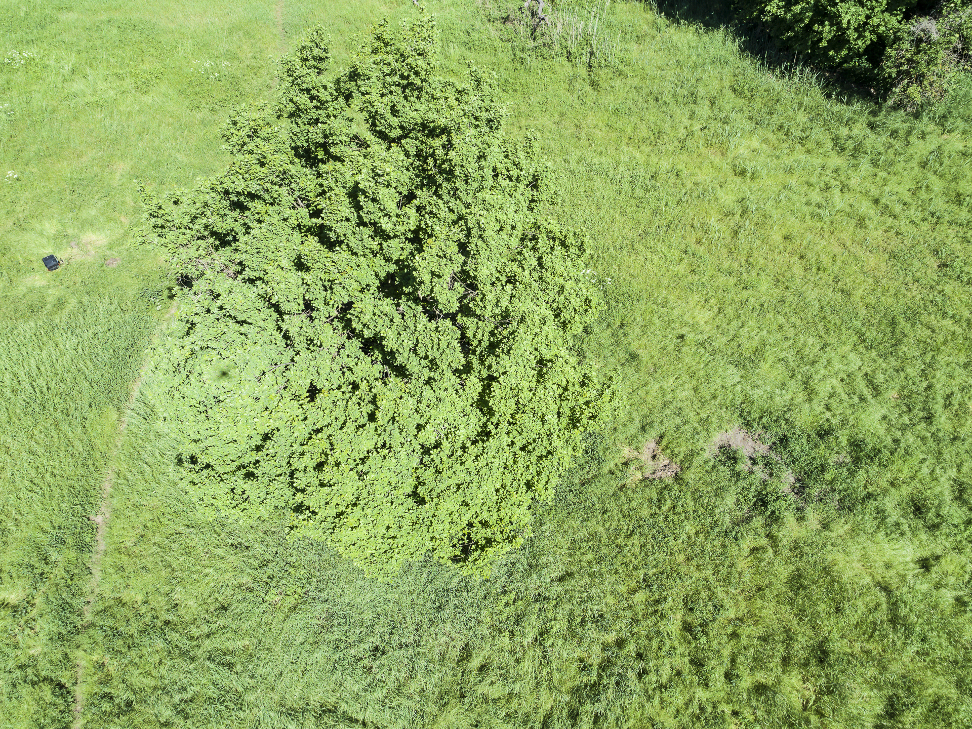
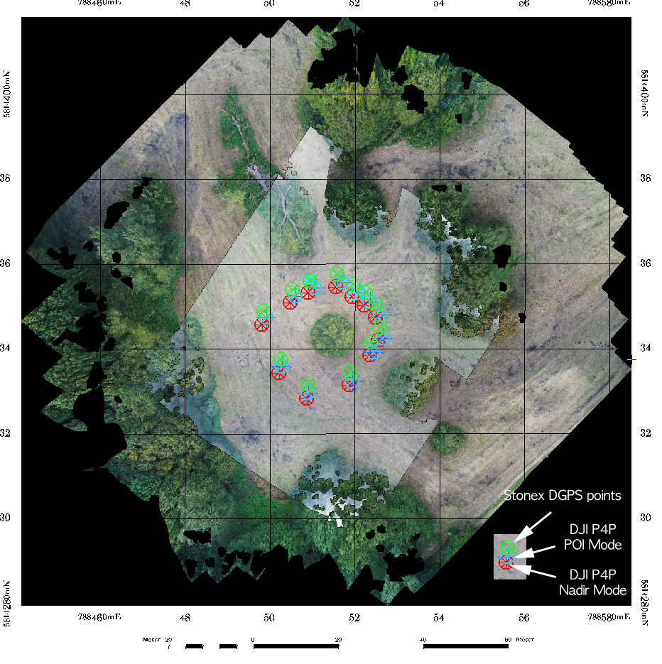
From a P4Pro test flight for agricultural within crop area variability analysis close to Erfurt for a agricultural application / cooperation. This flight campaign covered a 700×700 sqm area from 100m altitude (85/85 configuration in DJI GS Pro). With the standard battery the P4Pro had 30% battery power left at landing – so overall I believe, that approx. 0.7 –... Categories Agriculture/Quadrocopter
March 21, 2018 Hotspot Effects in Micro Copter Data A shot from last year vegetation point cloud mapping in Brandenburg. Strong Hotspot-Effect visible with easily visible shadow projection of the quadrocopter shape on the tree crown texture. Nice example of this direct back-reflection effect on vegetation (crown surface in this example), although you can also clearly see the same effect on the grassland vegetation in the neighborhood of the tree... Categories Agisoft/Crown Structure/Phantom/Quadrocopter
January 31, 2018 Punktwolkenmodelle für die Archäologie Die unterschiedlichen Datensätze der Befliegungen für die Grabungen auf dem Alten Gleisberg und bei Kuckenburg in 2017 sind nun vollständig an das Seminar für Ur- und Frühgeschichtliche Archäologie übergeben worden. Die abgeleiteten Datenlayer umfassen jeweils Punktwolkenmodelle im LAS Format, DSM (Digitales Oberflächenmodell ohne Normalisierung) und jeweils das Orthomosaik mit Georeferenzierung von der Befliegung. Alle Daten wurden nach UTM32 WGS84 georeferenziert. Insgesamt wurden Daten... Categories Archaeology/Phantom/Point Clouds/Quadrocopter
January 25, 2018 169. DVW-Seminar “UAV 2018 – Vermessung mit unbemannten Flugsystemen” 169. DVW-Seminar “UAV 2018 – Vermessung mit unbemannten Flugsystemen” : http://www.dvw.de/uav-seminar-2018 Categories General
January 10, 2018 Struktur Retreat des Lehrstuhls für Fernerkundung Struktur Retreat des Lehrstuhls für Fernerkundung im Rittergut Positz (10.-11.1.2018). 2 lange Tage mit Präsentationen, Diskussionen, viel Planungen für 2018, Gruppenbild vom Copter ;). Categories News
November 14, 2017 Absolut Accuracy of the Phantom 4 Pro Ortho Mosaic Some results from DGPS point measurements with a Stonex S9III GNSS DGPS receiver indicate an offset of 1.5-3 m to the Phantom 4 Pro ortho mosaic images. The relative accuracy is however much better. The Phantom 4 Pro derived ortho mosaic (without reference points) has a standard deviation of 0.31 to 0.36 m. When comparing the overall positional accuracy of... Categories Agisoft/Phantom
September 27, 2017 The ICAO legend For those not too familiar with the ICAO maps – its nice to have this overview at hand sometimes: The full PDF is available here: https://www.flightplanner.de/legenden/ICAO-D.htm Categories Uncategorized
September 26, 2017 “DJI GS Pro” – Ground Station Testing Some tests using the DJI GS Pro (Ground Station) software for automatic flight programming with the Phantom 4 Pro. New flight campaign at the Kuckenburg spot (Sachsen-Anhalt) finished with two different flight altitudes using DJI GS Pro – mapping the open archaeological excavation site of medieval church now in September 2017. This worked flawless – the only problem: you kind... Categories Archaeology/Quadrocopter/Software/Workflow
September 5, 2017 Paper Download from the UAV-g opened For those interested: the UAV-g in Bonn – that started this week – has all contributions as downloadable PDFs online here: Sessions Categories General/News