GEO409 Data Exploration in Remote Sensing
Inhalt:
Das Modul vermittelt fortgeschrittene Kenntnisse über weiterführende theoretische und praktische Grundlagen der angewandten Bildverarbeitung in der Fernerkundung. Inhalte sind fortgeschrittene Satellitendaten- und UAV-Daten-Vorverarbeitungsverfahren, Bildklassifikations- und Bildverarbeitungstechniken unter Verwendung von Expertensystemen der Objekt orientierten Bildverarbeitung mittels nicht-parametrischer Klassierungsverfahren. Die praktische Schulung findet im Schwerpunkt mit den Softwareumgebungen Trimble eCognition und R statt. Einige Analysen/Verarbeitungsschritte werden in GRASS/Geomatica, Adobe Lightroom, Agisoft Photoscan erarbeitet. Weitere Softwarepakete mit Relevanz sind DroneDeploy, Quick Terrain Reader (QTR) und DJI GO iOS-Implementierungen. Gegenstand der Übungen sind fortgeschrittene Verfahren der systematischen Datenvorverarbeitung, Merkmalsanalytik und Methodenentwicklung auf Basis räumlich sehr hochauflösender (VHR) Fernerkundungsdaten und UAV Daten in ausgesuchten aktuellen Anwendungsszenarien. Der theoretische Teil des Moduls wird von den Studierenden in Referat, Software-Demo, Ausarbeitung und Diskussion erarbeitet. Einige Übungen werden in 2-wöchigem Turnus erarbeitet. Zur Unterstützung werden eingeschaltete „Catch-Up“ Termine angeboten. Studierende sollten am Ende des Moduls über ein Repertoire von methodischen und praktischen Kenntnissen verfügen, welches zur selbstständigen wiss. Arbeit in verschiedenen Anwendungsszenarien von VHR Daten (Satellitendaten/Flugzeugdaten/UAV Daten) befähigt.
Veranstaltungsplanung | Themenlistung:
Einführungsveranstaltung: Themenüberblick | Modulvorstellung | Praxis-Themenvorstellung | Referat-Themenvergabe | Erläuterungen zur Modul-/Bewertungsstruktur | Software | Literatur | Software-Reader | Tutoriumstermine/Tutorenvorstellung (if any).
GRASS – Open Source EO data analysis (functionality, importing data, data preprocessing and analysis), R Integration in GRASS, d-/g-/r-/i-/v-commands, g.region, g.gisenv, r.in.gdal, g.list, d.mon, d.rast, r.info/report/stats, r.univar, r.mapcalc, r.covar, r.regression, r.atcorr, gstat), software demo.
Project work: introduction to eCognition – basics of OBIA for urban impervious surface classification in percent – segmentation in multiple levels, working with different scales, class-related sub-object features, (exporting to R, reading data, plotting data and exporting results). Berlin: block level – inheritance vers groups hierarchy, impervious, percent mapping with two levels and comparison with SenV statistics.
The OBIA paradigm – object oriented image classification – context and relations in image analysis – introduction to eCognition, R intro: installing, extensions, handling, interface, simple plotting) , software demo.
Project work: introduction to eCognition – basics of object based image processing (OBIA) class/process hierarchy development, inheritance vers. groups hierarchy, sample editor, membership function definition (manual vers. automatic), thematic layer integration, process/class h. export to shapefile and csv export (“export object statistics”) & R import for attribute analysis. Thüringen. Introduction to supervised Classification concepts in eC: exporting classifier statistics, Membership Function, Sample Editor, Landcover Classification using supervised sample based membership functions (“classifier” process, for train, apply and query of supervised Bayes, KNN, SVM, Decision Tree, RF).
Segmentation of image data: methods, applications, overview, eCognition segmentation strategies, Halcon, ENVI Segmentation (R: exporting to R, reading data, 2D plotting, graphical display modes and exporting results to R), software demo.
Stelen Counting (Mahnmal), Segmentoptimierung und Neighbourhood relations, introduction to relational features (number of stelenobjects in search radius to every stelen object). Shape/direction parametrisation. Introduction to “Customized Algorithms” variables in eCognition.
UAV Data Mapping – operation of UAVs, UAV sensors, data types, formats, data preprocessing and SfM processing of image data to georeferenced point clouds, DGMs and ortho image mosaics, POI flight modi, corridor mapping, App based nadir mapping, analysis strategies/software solutions (introduction to Adobe Lightroom and Agisoft Photoscan, workflow and chunk handling, processing time and multicore options, LASTools (las and laz/obj file formats), point cloud height normalisation, interpolation to raster data, import of point cloud data in laz format to eCognition and OBIA point cloud classification in eCogntion).
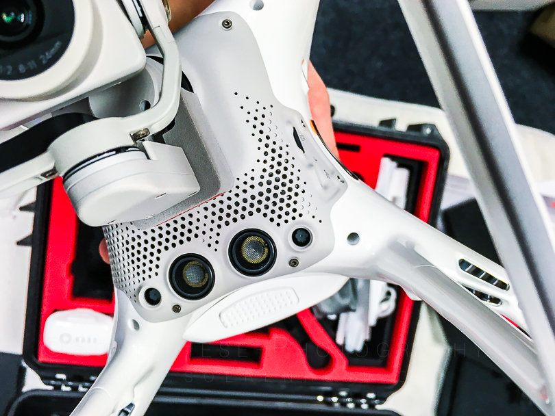
UAV Lab exercise & in the field flight planning: Practical data mapping situation (on vegetation) using a Phantom 4Pro/3A and DroneDeploy iOS based mapping software – (date depending on weather conditions – tbd).
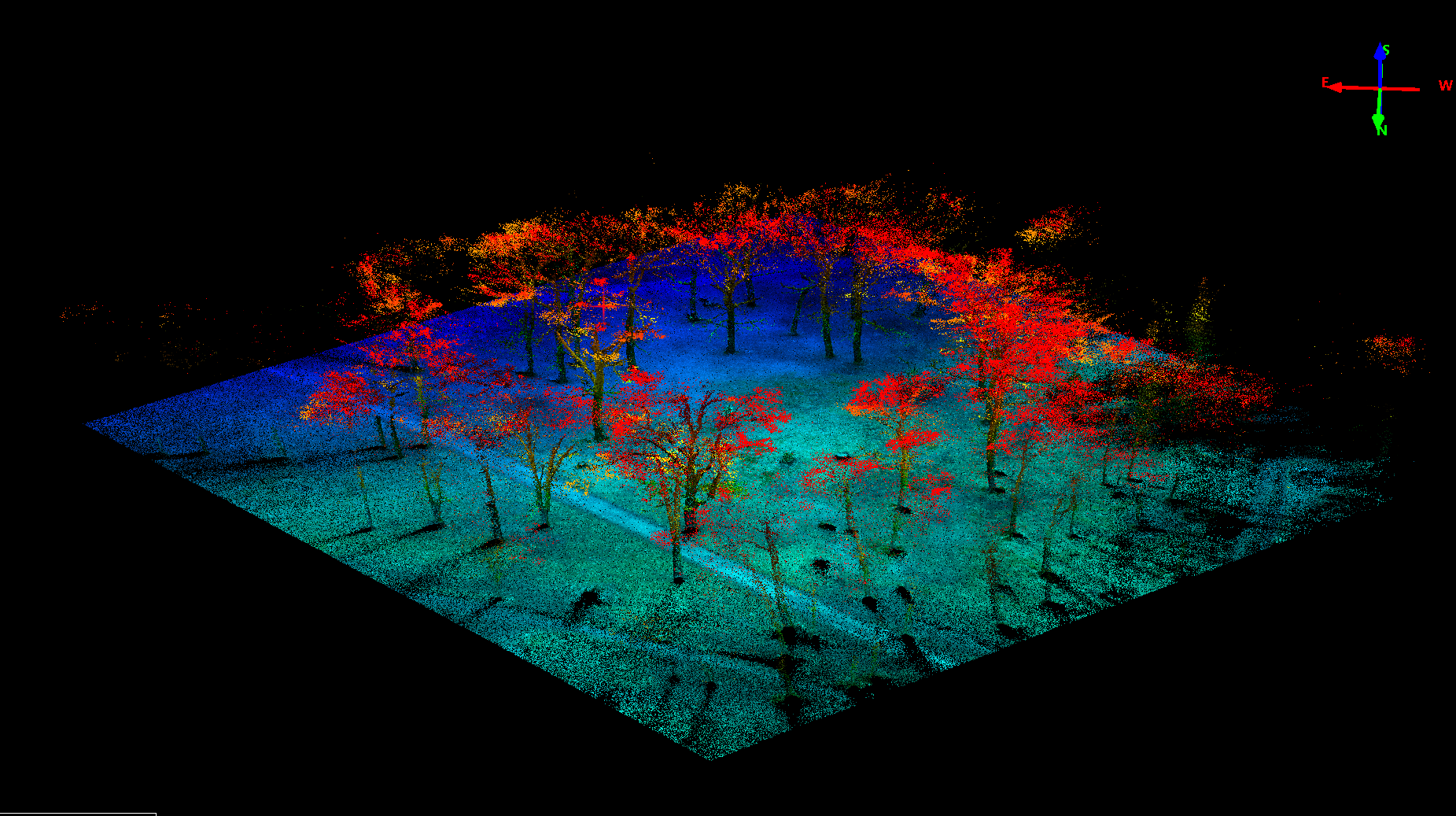
Lab exercises: mapping exercise using a 4ha test area (Paradise parc region with grassland and tree vegetation and/or “Jena Experiment” region mapping in coop. with the “Jena Experiment” Team).
Adobe Lightroom introduction: importing RAW DNG files, DNG file handling, preprocessing CA correction, profile application, geometric correction, noise reduction and sharpening.
Agisoft Photoscan introduction (UNIX based demo): importing GPS tagged JPEGs, workflow and performance considerations, products (point clouds/orthos/DGM) and processing options.
UAV application scenario: Species classification in cm resolution data, shape and volume classification, point densities calculation, DGM parameter derivation.
Local max and valley following, Template Matching concepts in image data classifications for forest applications, how to build a 2.5D shape based multistage classification system (R: box plotting in R and advanced plotting commands in R, uni vari. statistics in R) , software demo.
Project work: building an effective class hierarchy for deciduous tree object classification (Sanssouci landscape parc, Potsdam), process-hierarchy design for object shape optimisation, designing a process hierarchy, introduction to
- “local maximum” and
- “Template matching” concept/analysis in high res. DSM data for individual tree top detection.
- Masking techniques,
data: HRSC-A multispectral data and normalised DSM data, Potsdam, Ex.: Extension & optimisation techniques for deciduous tree top object classifications / growth thresholds.
Structural image object classification (from pixels to objects to structures in urban regions), (R: geo support in R: extensions, formats, projections, classification in R), software demo.
Data analysis strategies: concept development/hypothesis – conceptual model of reality – integration – validation – visualisation, from Image Processing objectives to effective implementation – guidelines for a structured approach, robust & transferable image data features, what2avoid, 2h lab-exercises +2h tutorial. Introduction to
- Array, Array Variables,
- Maps, and synchroniziging maps
- local processing using PPO(0) and “while expressions” with “current image object” domain definition
- counted definition in “current image object” definition for “while constructions”.
- Calculating of in-between Object directions.
Exercise: Project work: Berlin-vers-Köln, urban structural concepts (ring vers. 2 ring vers. Modular, vegetation connectivity, transect analysis …)
Ex.: object-oriented classification of urban land use, structural urban land use mapping with airborne & orbital data – classification in different segmentation levels, horizontal and vertical object/class relations, relational custom features for neighbourhood image structure analysis, data: Quickbird/Ultracam data Berlin/Germany, data analysis strategies: concept development/hypothesis – conceptual model of reality – integration – validation – visualisation, from image processing objectives to effective implementation – guidelines for a structured approach, robust & transferable image data features, what2avoid,
Auto correlation measures, Morans I index, Geary C, Variogram Analysis, Shape & Texture for Earth Observation Data Analysis, are scale robust shape descriptions possible? Overview, implementations, software alternatives, feature groups (R: auto correlation and Geostatistics, multivariate statistics in R, software demo. Local max and template matching revisited – image correlation with multiple templates, tree species classification using a VHR copter DCM datasets and multispectral data to derive a multidimensional correlation surface for species discrimination.
Intro to working with multiple maps, intersect sync of maps, working with multiple templates and adjusting threshold functions.
Landscape metrics for urban structure mapping, software, data types, metrics definitions (fragstat, R and GRASS r.li.setup, r.li.patchnum, r.li.richness, r.li.simpson), software demo
Change detection – methods, algorithms, concepts, problems in Earth observation based change analysis (multi data change/ two date change / post classification change analysis. Limitations using multi-date segmentations, shape-change? What is change?, software demo,
Project work: 3-Date spectral change signature mapping, Ex.: tsunami event impact mapping, maps concept for object based multi-date change mapping [SH], data: uncorrected multitemporal Rapideye data (Japan) from 2010 (original status), 2011 post tsunami 12.3.2011 and first recover status 8.2011&2012), optional: Lena River Delta change Analysis.
LIDaR and photogrammetric Point Cloud Data Import and Volume and 3D Shape Analysis import/interpolation/interpretation: applications, limitations, most recent developments (R? / Geomatica/LASTools, analysis approaches), software demo. Project work: point cloud importing from ASCII xyz data files, conversion, interpolation and gridding to DSM, nDSM processing using an urban regional normalization approach.
Scenario work: nDSM calculation with local min detection in various search radi, nDSM based cadastre update for the urban area of the city Erfurt. Data fusion with the SGK Erfurt and change mapping scenario for Erfurt.
Final Session 3.2. (2x2h) results reviewed, demo solutions, summing up, results review/409 review/lecture reader design definitions/open ULE Modul-discussion (SH).
2 SWS presentations, software demo, discussion + 2SWS lab exercises
Rapideye/Ultrcam/Quickbird/Ikonos Erdbeobachtungsdaten der praktischen GEO409-Modulübungen dürfen ohne vorherige Genehmigung nicht in anderen Projekten oder wiss. Arbeiten genutzt werden! Dies betrifft auch kleine Datensatzausschnitte!
Literature:
- Liang, S., (editor) 2008. Quantitative Remote Sensing of Land Surfaces, J.Wiley & Sons, ISBN: 0471281662;
- Neteler, M., Mitasova, H., 2010. Open Source GIS: A GRASS GIS Approach, 3rd Edition, Kluwer Academic Publishers, SECS773, ISBN-13:978-1-4419-4206-7
- Barnsley, M.J., 2007. Environmental Modeling, A Practical Introduction, CRC Press, Taylor&Francis, ISBN-10: 0415300541
- Trimble eCognition Users Guide/Tutorials/Working Note
- Agisoft Manuals // las/laz format documentation / Working Note
- Adobe Lightroom CC documentation / online and PDF provided
- LASTools documentation (online)
- ATCOR Working Note
Moodle Online study support.
A contribution to the Master of Science Geoinformatics study program of the Earth observation department of FSU Jena.