Wild Boar Damage Mapping in Maize Fields
As part of the disturbance mapping project we captured 300 ha of maize field area to investigate wild boar damages in the direct neighborhood of the Hainich National park area – a cooperation of the Earth observation department of FSU Jena, DLR Jena and NLPV Hainich.
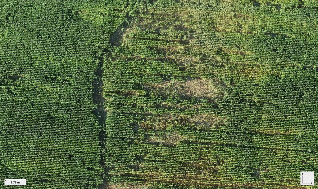
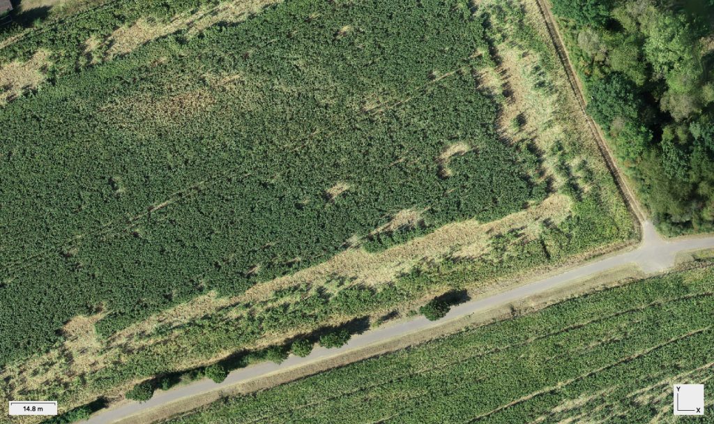
Wild boar damage mapping in agricultural areas – the wild boar finds perfect conditions in the Hainich National Park region – unfortunately these animals use the maize fields in direct neighborhood of the parc area as food supply. The economic damage creates a need for mapping concepts … . The department for Earth observation is directly involved in mapping wild boar related damages with satellite images. As reference quantification however we used the Phantom 4 RTK now and captured 300 ha of image data close to Berka vdH, Kammerforst and Lauterbach. The derived ortho mosaics and elevation data will be used to directly differentiate damage classes. These activities are part of a cooperation with the Hainich National Park and with direct contact to the farmers.
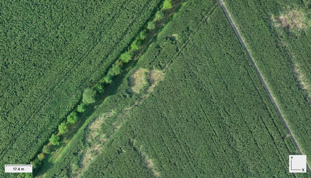
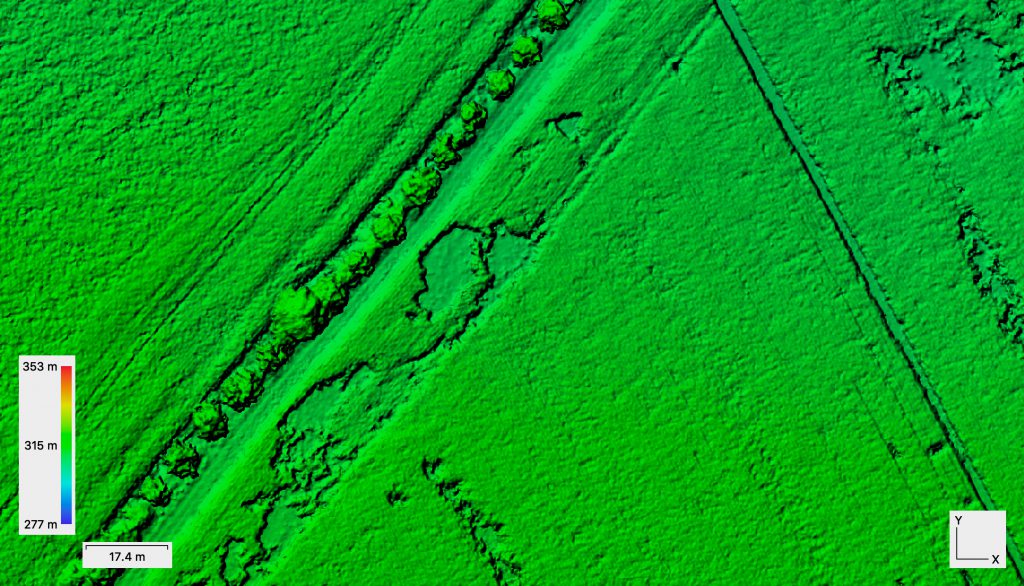
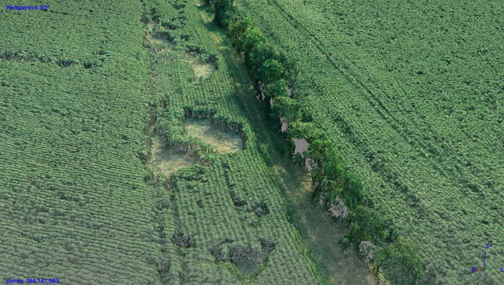
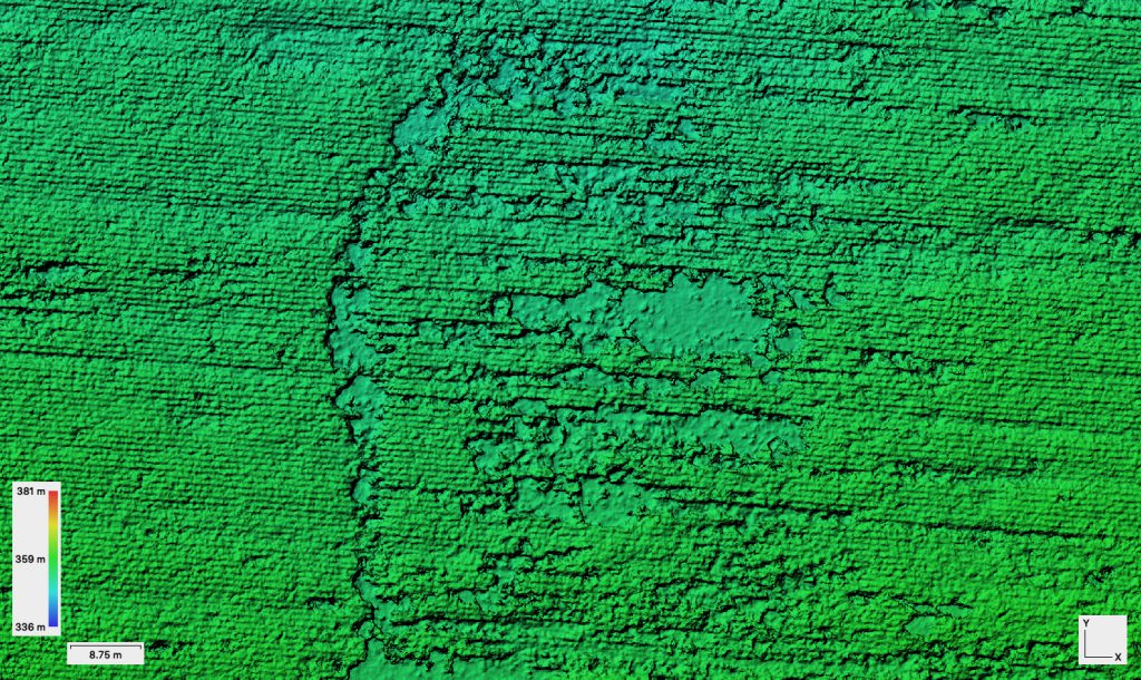
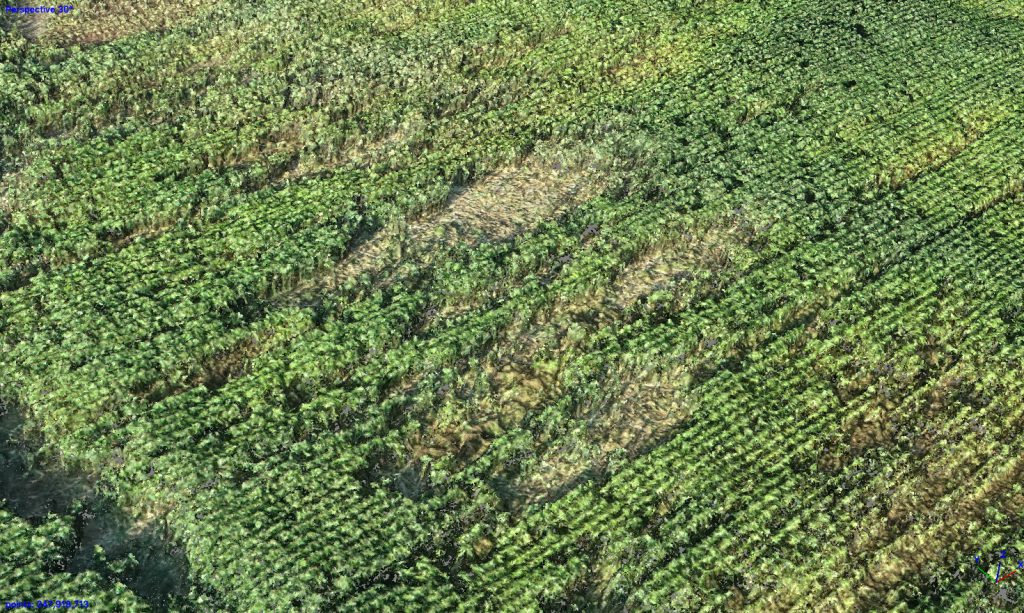
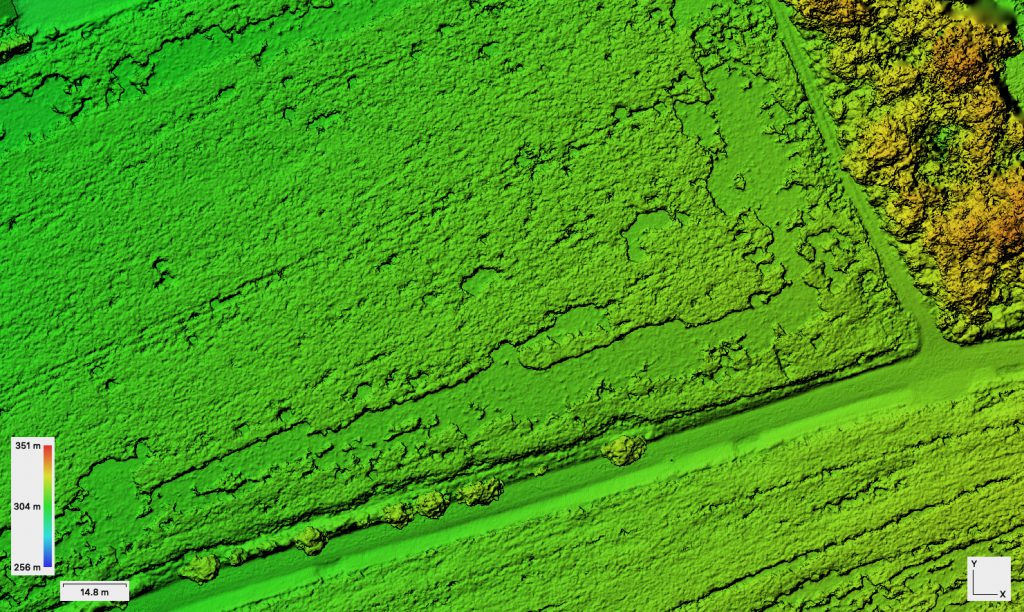
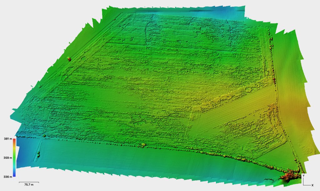
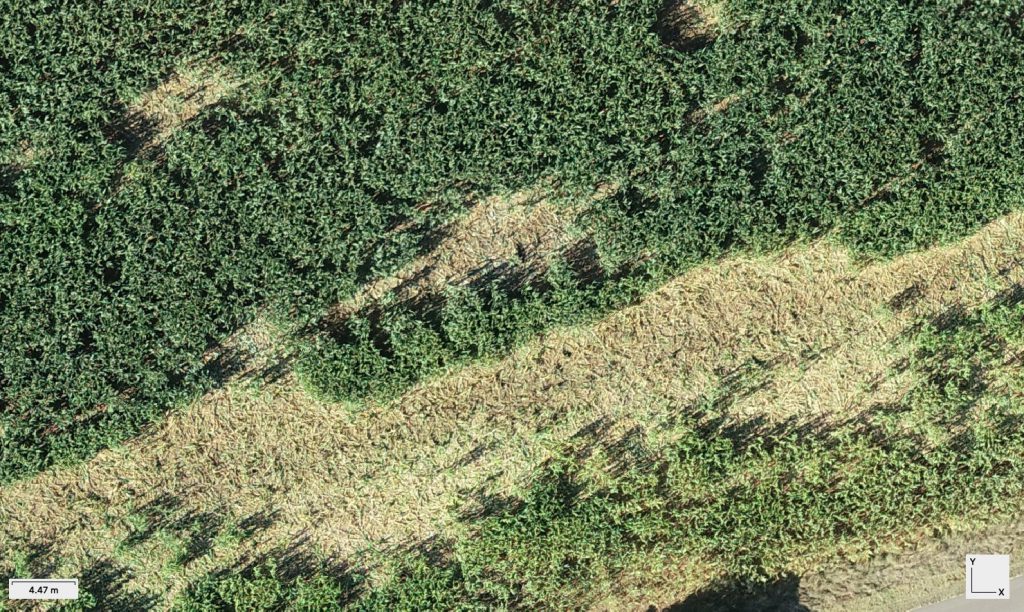
High resolution point clouds also allow to directly investigate surface roughness of disturbed field areas. Ortho mosaics usually cover areas of 2-3 flights in 75/80 overlap configuration. Usually this covers an area of approx 100 ha. Having 8-10 batteries we can cover up to 400 ha a day. With recharging 500-600 ha is clearly possible. Spatial resolution of the RGB data is in the range of 4.5 – 5 cm. Absolut georeferencing accuracy is in the 1-2 cm range. With these flight campaigns we do not calibrate to reflectance but using the MicaSense MX this is easily possible. But so far we do not use the MicaSense on the RTK system. The MX is installed on a standard P4 Pro and the datasets will be registered to the RTK data in post processing.
Data processing will include normalizing the DEM to an nDEM and investigating the surface roughness and textural properties – the properties of stamped to ground plants in an OBIA environment.