“DJI GS Pro” – Ground Station Testing
Some tests using the DJI GS Pro (Ground Station) software for automatic flight programming with the Phantom 4 Pro.
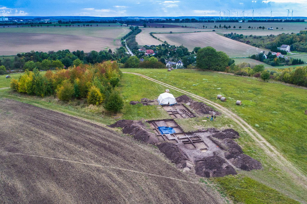
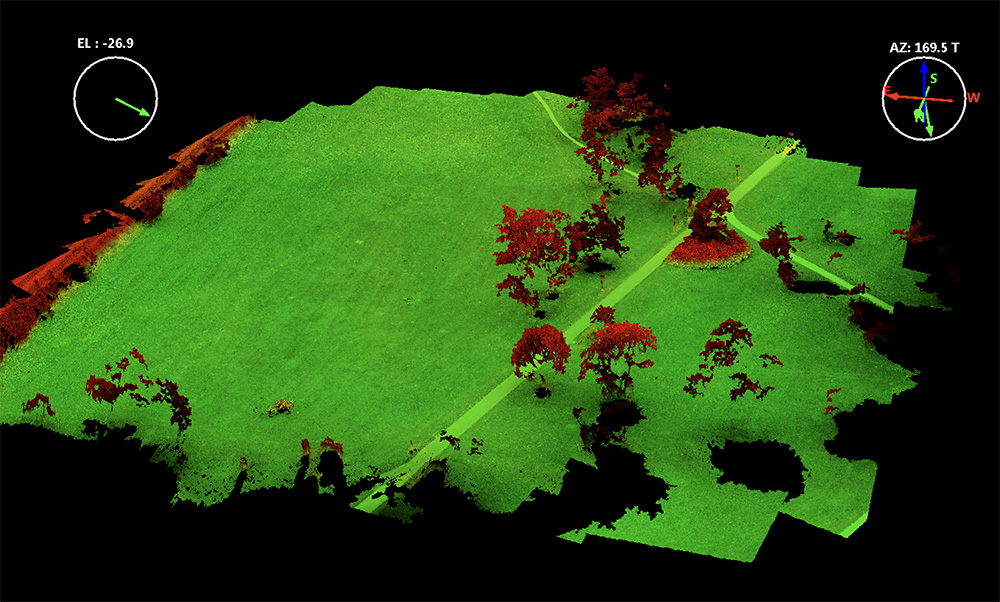
New flight campaign at the Kuckenburg spot (Sachsen-Anhalt) finished with two different flight altitudes using DJI GS Pro – mapping the open archaeological excavation site of medieval church now in September 2017. This worked flawless – the only problem: you kind of need a mobile connection with your iPad. Since DJI GS is an iPad-only software I used a hotspot from the iPhone to bring the iPad online. Its not perfect but it works. Overall I find DJI GS Pro to be more easy to program and to setup than Drone Deploy. The interface has more option to setup – so it is at first more complex but it integrates into the DJI Go App and so far my impression is that it is not giving these unexplained copter start problems that Drone Deploy sometimes showed. GS also seems to be less integrated into a subscription model and looks like a standalone software solution – though a DJI account is needed. I havnt tested capturing DNGs. Its not a direct option as far as I can see – this could be a limitation. You can easily modify exposure times and f-stop numbers even when flying to geht sharper shots. There is however so far no option to switch from JPEG to DNG. As this is usually only limited by bandwidth it could be an option that is available when you decrease the flight speed (leaving enough time between exposures) – so not tested yet.
As an in-App purchase you also can automatically do POI flights – this is very handy for these dense point clouds of single objects and its not so straight forward to do this in manually POI mode as part of the DJI GO software (though also possible).
DJI GS Pro however has some strange ways to handle waypoints when you use the hover method but once you understand where the problem is (the number of waypoints is restricted to 99) – it works nicely. DJI GS Pro also comes with different modi – “Virtual Fence” is very nice for training and restricting the flight space, “3D-Map Area” is for mapping of larger areas and “3D Map POI” is for these POI flights where you want to map 3D object structures and where you have enough space between objects to create some kind of circumnavigation.
The full manual goes here: https://dl.djicdn.com/downloads/groundstation_pro/20170831/GS_Pro_User_Manual_EN_V1.8.pdf
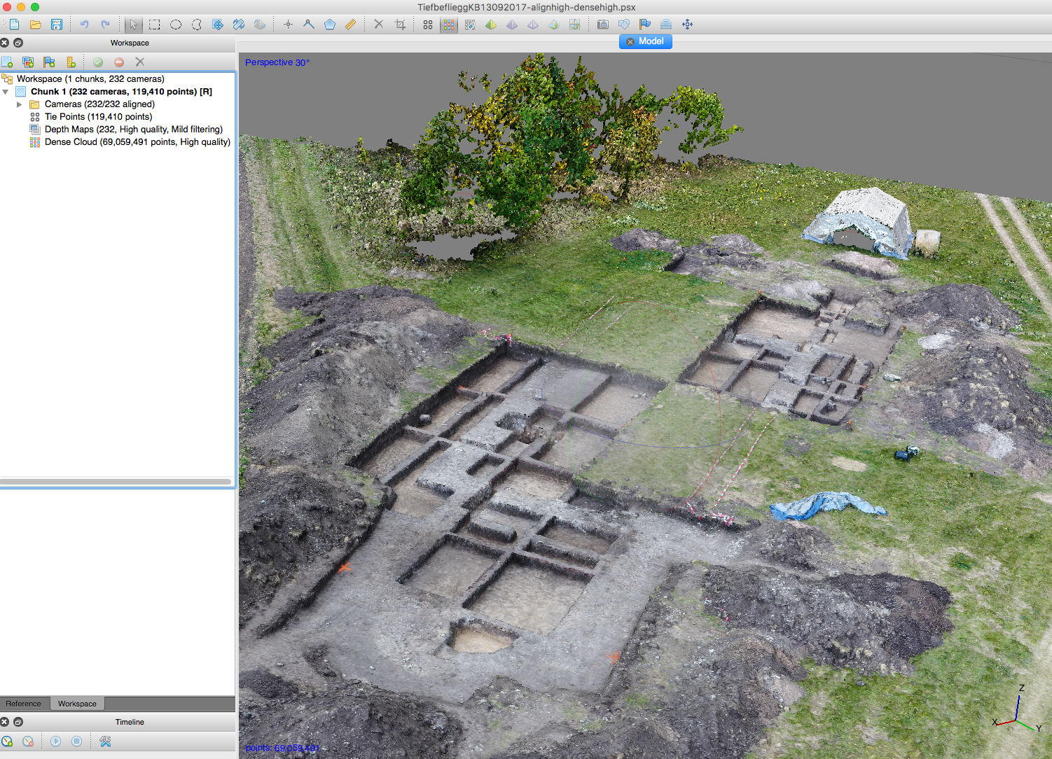
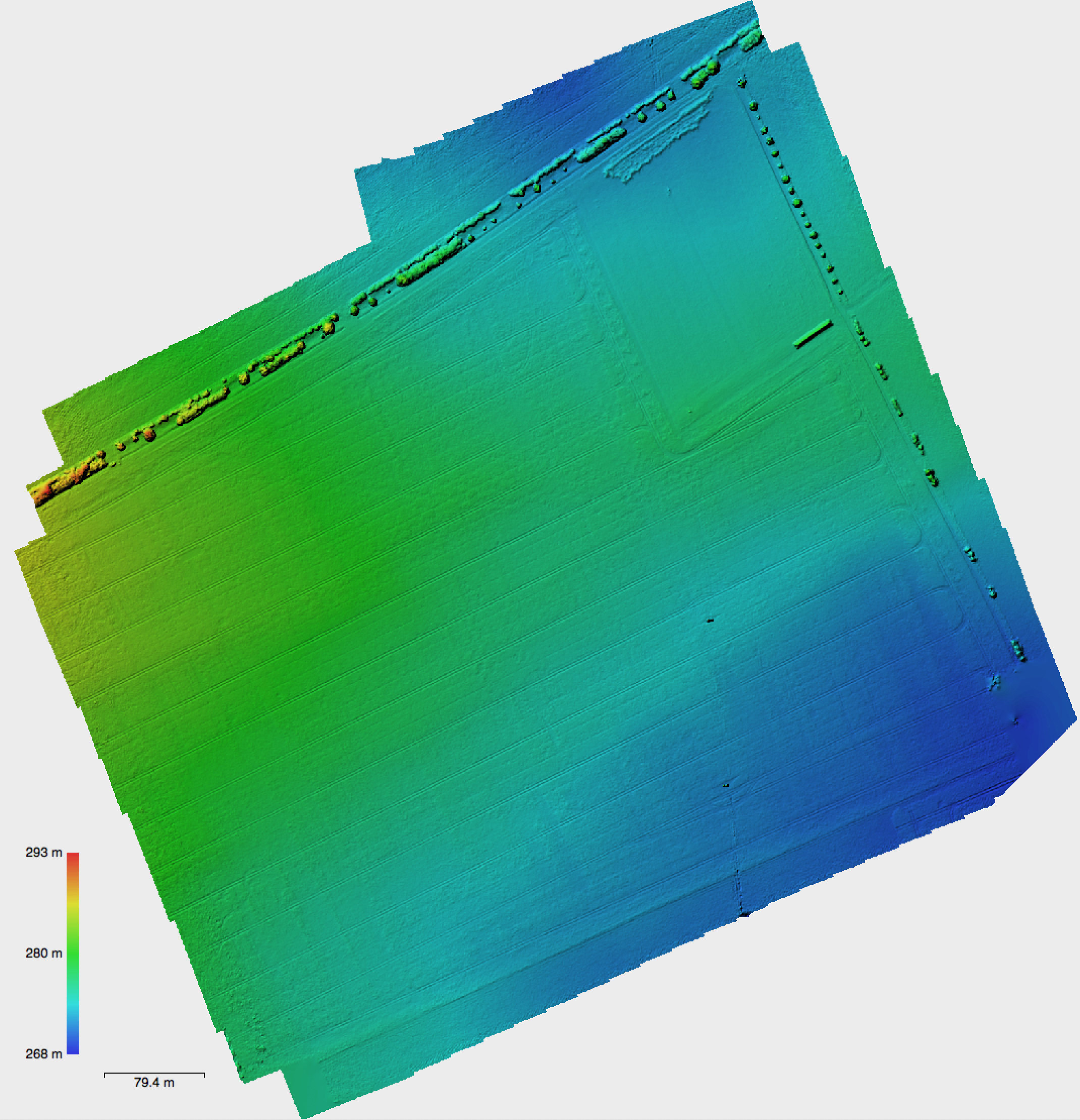
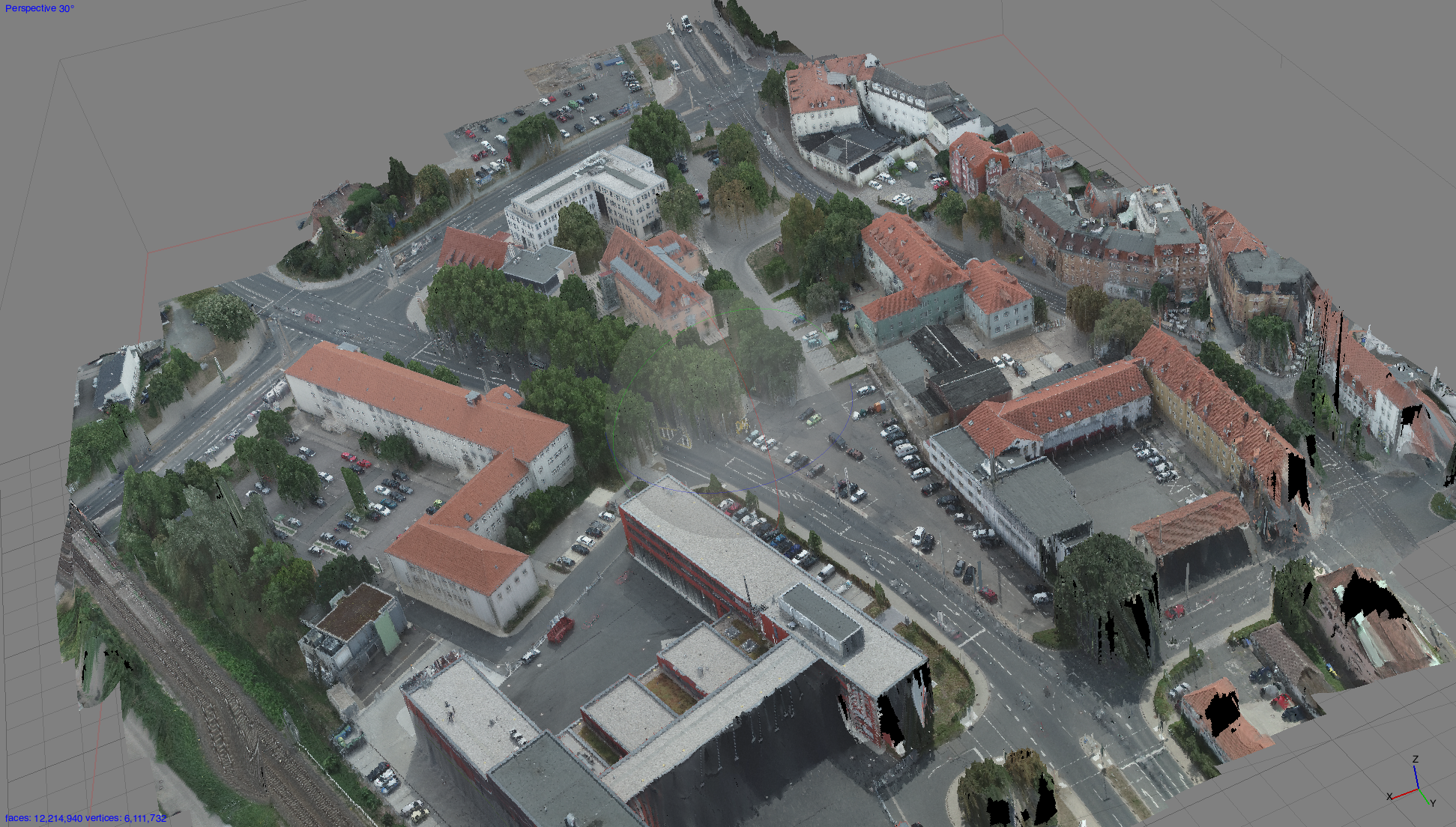
Some shots from the Kuckenburg flight campaign with 500 DNG shots and approx. 50Mio and 80Mio points in different dense point cloud calculations with Agisoft. As we don’t have a SAPOS subscription for “Sachsen-Anhalt” no DGPS points were measured. However some fixed points from the FSU Jena excavation team will be used.