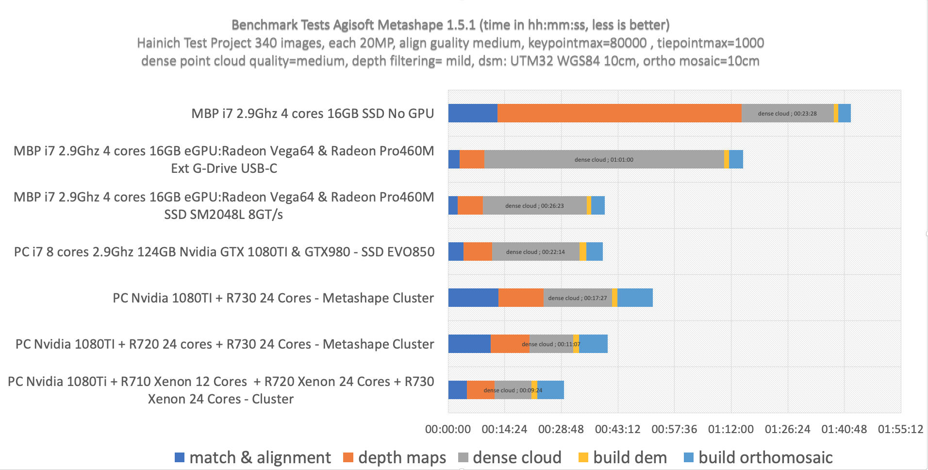
Home > Software / Teaching / Workflow Data Preprocessing with PCI and Python Satellite Data Preprocessing with Python/PCI I (Import & Ortho) Satellite Data Preprocessing with Python/PCI II – Cloud Masking, Haze Removal, Terrain Derivates – ATCOR Categories:SoftwareTeachingWorkflow Sören Hese Related Posts Agisoft / Point Clouds / Software / Workflow Speeding up Agisoft Photoscan Agisoft / Reviews / Software / Workflow Apple M4Max and M1Max 24C and 32C and Agisoft Metashape – a Performance Surprise (Updated) Agisoft / Software / Workflow Cluster & Batch Processing in Agisoft Metashape COVID-19 / Teaching / Workflow SARS-CoV-2 Cartograms Archaeology / Quadrocopter / Software / Workflow “DJI GS Pro” – Ground Station Testing News / Workflow MicroSD cards and standards … Prev Post Intra field growth variability Next Post Erste urbane Copter Befliegung über Jena
Agisoft / Reviews / Software / Workflow Apple M4Max and M1Max 24C and 32C and Agisoft Metashape – a Performance Surprise (Updated)