Home > "forest decline" / Crown Structure / Forest decline / Phantom / Point Clouds / Publications / Quadrocopter Beech Tree Decline Mapping Project – the Logbook of the Hainich National Park Activities and Vegetation Damage Mapping over Historical Deciduous Forests Beech Tree Mortality Analysis in the Hainich National Park Area – the Logbook Categories:"forest decline"Crown StructureForest declinePhantomPoint CloudsPublicationsQuadrocopter Sören Hese Related Posts Point Clouds / Reviews / Workflow Some Thoughts on the Copter Data Processing Workflow "forest decline" / Quadrocopter MDR Doku with EO contribution News / Quadrocopter New Regulations for Copter Flying "forest decline" / Crown Structure / Forest decline / Phantom / Quadrocopter UAV Flights in May 2020 over Hainich NP "forest decline" / Crown Structure / Forest decline / Phantom Stand Gap Analysis in the Hainich National Park between 2018 and 2020. Agriculture / Quadrocopter Intra field growth variability Prev Post CIR Airphoto Classification and Planning for 2020 Next Post UAV Flights in May 2020 over Hainich NP
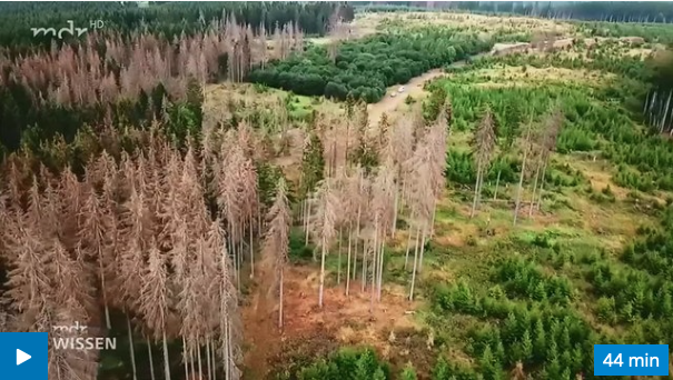
"forest decline" / Crown Structure / Forest decline / Phantom / Quadrocopter UAV Flights in May 2020 over Hainich NP
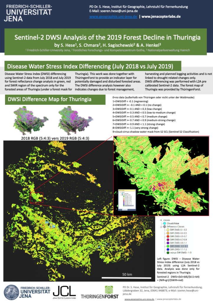
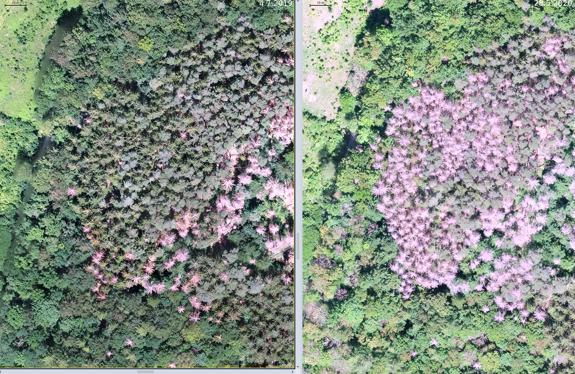
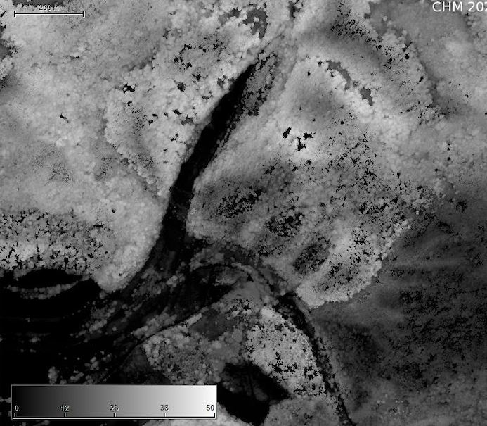
"forest decline" / Crown Structure / Forest decline / Phantom Stand Gap Analysis in the Hainich National Park between 2018 and 2020.